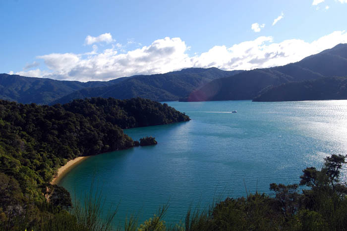
Picton is the gateway to the South Island and the main town of Queen Charlotte Sound. Today is sunny and cool, so I have decided to explore five short walks from Queen Charlotte Drive. The thirty-four kilometre drive starts behind Bluebridge Ferry Terminal in Picton and finishes at Havelock.
From Picton i-SITE, I follow the signs to Queen Charlotte Drive and continue uphill behind the ferry terminal until I arrive at Queen Charlotte Lookout. It is a popular lookout where you can view Picton township and the many bays, coves and headlands along the waterway.
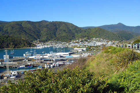
Picton Harbour
|
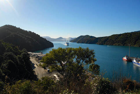
View from the lookout
|
The Marlborough Sounds are drowned river valleys formed by earth subsidence and rising sea levels during the last ice age. Part of this process is still happening now. The land is slowly sinking.
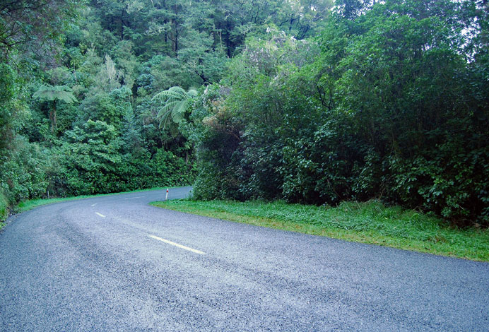
Continuing on Queen Charlotte Drive, the narrow road winds past Shakespeare Bay towards Wedge Point. Tall tree ferns and lush native bush hug the hillsides and gullies, and to my right, I have glimpses of bays and distant views. Eventually, the road cuts across Wedge Point into Grove Arm.
Shakespeare Bay
|
The road to Wedge Point
|
In the past, Grove Arm was subjected to land clearance; now, patches of pine trees, broom and gorse intermingle with the native forest. Fortunately, kanuka and manuka have made a comeback providing a cosy habitat for ferns and native tree seedlings to grow.
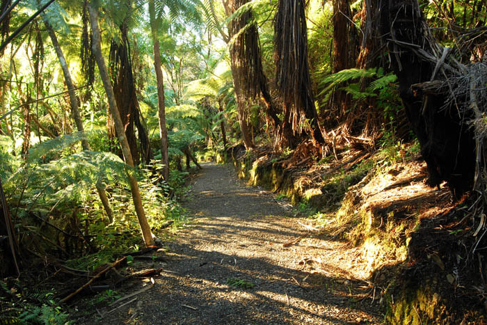
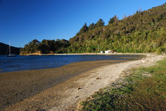
After many twists and turns, the road comes to Governors Bay Scenic Reserve. From the car park, there is a ten-minute walk downhill to the beach. Once inside the forest, I am sheltered from a cold wind and take my time.
Overhead, tree fern fronds, kamahi and kanuka form a canopy. Rangiora, five-finger and kawakawa fringe the edges of the track. Soon I am at the beach.
The bay is between two headlands, and the narrow beach is made of coarse golden sand with bush fringing the edges. It is almost a gale on the beach, and even the black-backed gulls are crouching low. It is too refreshing for my liking, so I retreat into the forest.
Looking down towards Govenors Bay
|
View towards road entry for Ngakuta Bay
|
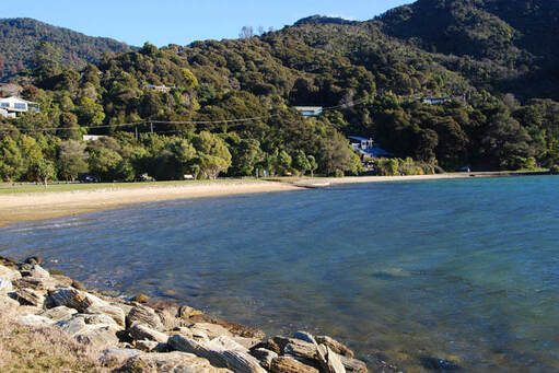
After leaving Governors Bay, it is a short drive to Ngakuta Bay. This small holiday settlement is tucked away in a valley. You can access the beach at the far end of the main road, where a fifteen-minute walking track follows the foreshore and loops back via the road.
After parking the car and putting my beanie on, I follow the track and head towards two screeching pukekos having a stand-off in the rushes. Further out on the tidal flats, a white-faced heron and two black oystercatchers are being buffeted by the wind while looking for food.
There is also a good interpretation board with pictures of bird species at the bay's western end. Eventually the track climbs some wooden steps to the road and follows the footpath past modern holiday homes and older baches. Soon after, I am back in the car.
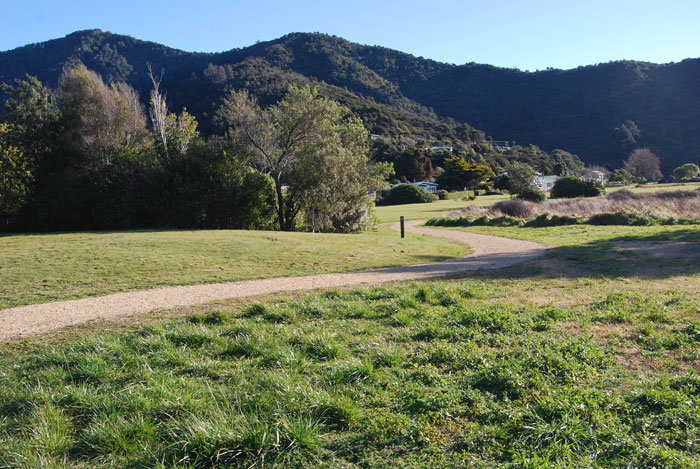
The road continues to skirt above the bays until you arrive at Momorangi Bay. The bay has a Department of Conservation camping ground and store. Behind the camping ground is a twenty-minute walk called the Momorangi Forest Experience.
Easy walking, Ngakuta Bay
|
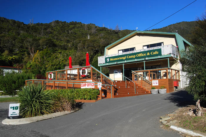
Momorangi Camp Office
|
This forest is part of a continuing restoration project by the Department of Conservation and volunteers. The Community Ranger said, "Between 2013 and 2016, they had over one hundred and fifty volunteers undertake three hundred and thirty-six hours or forty-two equivalent work days".
Away from the wind, the forest becomes a quiet sanctuary. As I dawdle along, a tui's melody fills the space around me. Mature silver and black tree ferns intermingle with other forest trees forming tall, silent groves.
There are signs and panels with pictures and descriptions of trees, birds and pest species. At the bird species panel, an audio box allows you to play eight different bird songs. Eventually, the track meanders back to a lawn area behind the camping ground.
Groves of tree ferns, Momorangi Bay
|
Northeast end of Momorangi Bay
|
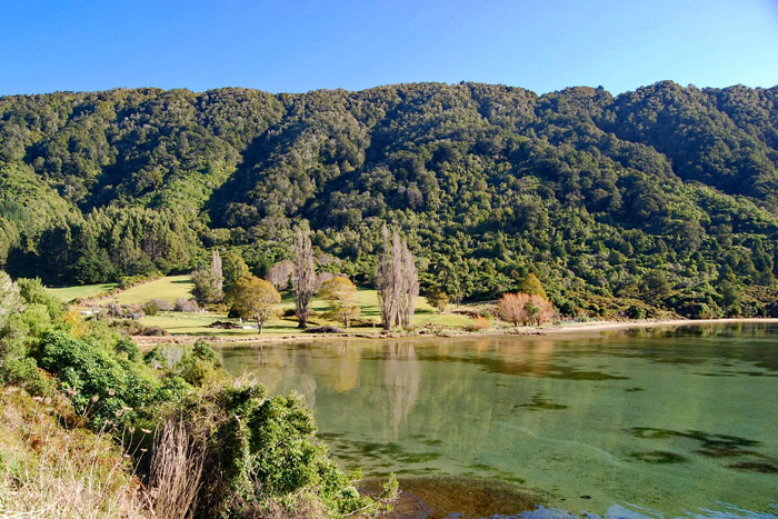
From Momorangi Bay, the road gently winds its way towards Linkwater. Linkwater settlement is spread out with lush pastureland on either side of the road. It separates Queen Charlotte Sound from Pelorus Sound. You can turn off here to the start of the Queen Charlotte Track at Anakiwa.
As the road continues, it hugs the bay winding around marshes and the tidal flats of Mahakipawa Arm until it climbs uphill and eventually to Cullen Point. From the car park at Cullen Point, I can see Havelock and the reason why it is so freezing; in the distant southwest, the mountains are covered in vast amounts of fresh snowfall.
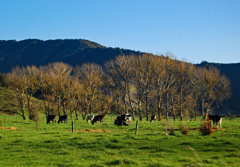
Lush pastures at Linkwater
|
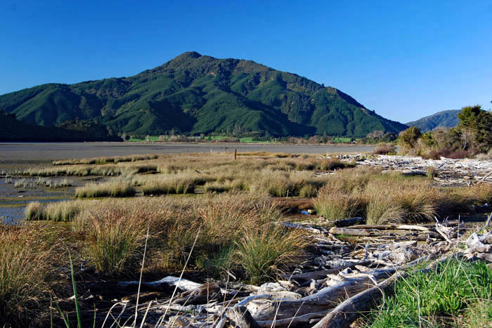
Tidal flats Marshes at Mahakipawa Arm
|
At Cullen Point, there are two walks called Cullen Point Coastal Walk and Cullen Point Lookout Walk. The Coastal Walk descends to the shoreline and follows the base of the headland around. It is a one-hour loop track. The wind has gone, but it is late afternoon, and a coldness invades the air; however, after ten minutes of walking, I am warm again and begin to enjoy the forest. Whiteywood, fivefinger and groves of tree ferns inhabit the gullies and hillside.
At clearings, I stop and watch seabirds searching the tidal mudflats for a feed. My first spotting, with binoculars, is a royal spoonbill. I am thrilled and watch it sweeping its bill side to side. The royal spoonbill used to be considered a vagrant to New Zealand waters, but after a hundred years of visits and breeding, it has become colonised.
Other birds I can see are oystercatchers, gulls, terns, gannets and pied shags. The track is narrow and muddy in places, but it is not too demanding. Finally, after an hour and a gradual uphill climb, I arrived at the car park.
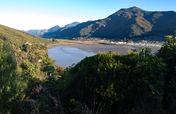
View of Havelock from Cullen Point
|
View from lookout into Mahau Sound
|
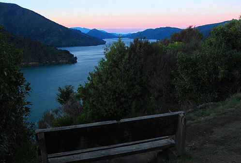
The lookout is a twenty-minute return walk. Now the sun is almost behind the last ridgeline. The main track starts out flat and wide and then becomes a narrow dirt trail to the top. From here, there is a short ridge to meander along and a seat with views of Mahau Sound.
Although the light is fading, I enjoy the pinkish tinge of twilight and then quickly hurry back through native forest and rejoin the main track. Back at the car park, I jump into my car and travel the remaining five kilometres to Havelock.